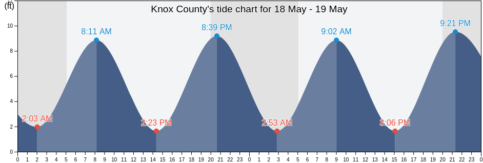
Knox County tide charts for today, tomorrow and this week

Knox County, Maine, United States tide chart

Sunday 28 April 2024, 7:42AM EDT (GMT -0400). The tide is currently falling in Knox County. As you can see on the tide chart, the highest tide of 10.17ft was at 2:06am and the lowest tide of 0.33ft will be at 8:33am. Click here to see Knox County tide chart for the week.

Next high tide

Next high tide is at
2:49pm

Next low tide

Next low tide is at
8:33am

Tide times for Knox County

Tide table for Knox County this week
Day Tide times for Knox County Sunrise and sunset
1st Tide 2nd Tide 3rd Tide 4th Tide
Sun 282:06am
10.17 ft
8:33am
0.33 ft
2:49pm
8.86 ft
8:40pm
1.64 ft
5:32am 7:37pm
Mon 292:52am
10.17 ft
9:22am
0.33 ft
3:39pm
8.53 ft
9:31pm
1.64 ft
5:30am 7:38pm
Tue 303:45am
9.84 ft
10:16am
0.33 ft
4:35pm
8.53 ft
10:29pm
1.64 ft
5:29am 7:40pm
Wed 14:44am
9.84 ft
11:16am
0.66 ft
5:37pm
8.86 ft
11:35pm
1.64 ft
5:28am 7:41pm
Thu 25:50am
9.84 ft
12:19pm
0.33 ft
6:41pm
9.19 ft
5:26am 7:42pm
Fri 312:44am
1.31 ft
6:58am
9.84 ft
1:22pm
0.33 ft
7:43pm
9.84 ft
5:25am 7:43pm
Sat 41:51am
0.66 ft
8:05am
10.17 ft
2:21pm
0 ft
8:40pm
10.5 ft
5:23am 7:44pm

Best fishing times for Knox County today Today is an average fishing day

Major fishing times

From 3:05am to 5:05am

Lunar Transit (moon up)

From 3:33pm to 5:33pm

Opposing lunar transit (moon down)

Minor fishing times

From 11:33pm to 12:33am

Moonrise

From 7:37am to 8:37am

Moonset

Click here to see Knox County fishing times for the week.

Current weather in Knox County

Cloudy

Weather

Cloud cover 80%
Temperature

Temperature

45°F
Min 44°F/Max 48°F
Wind

Wind

13 mph
Wind gust 22 mph
Humidity

Humidity

86%
Dew point 41°F

Click here to see Knox County weather for the week.
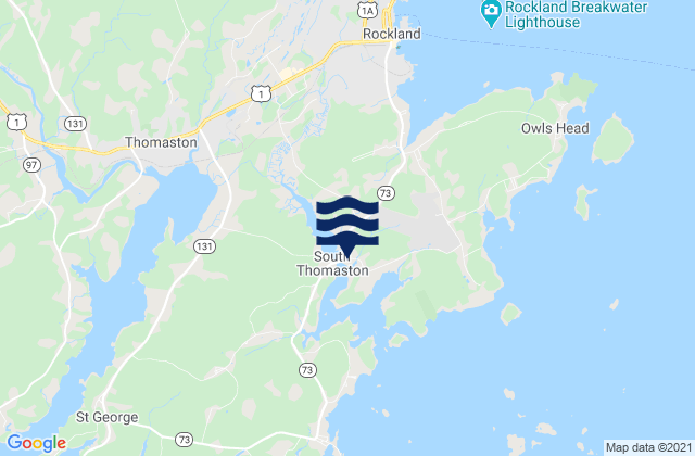
Today's weather in Knox County

The sun rose at 5:32am and the sunset will be at 7:37pm. There will be 14 hours and 05 minutes of sun and the average temperature is 45°F. At the moment water temperature is 40°F and the average water temperature is 40°F.

Weather forecast for Knox County today
0 h 3 h 6 h 9 h 12 h 15 h 18 h 21 h 24 h
Partly cloudyPartly cloudyCloudyPartly cloudyCloudyCloudyCloudyPatchy rain nearbyPatchy rain nearby
45°F45°F45°F45°F44°F44°F45°F46°F48°F

Click here to see Knox County weather for the week.

More tide and marine information for Knox County

Regions and cities in Knox County, Maine, United States

Andrews Island ESE ofHead of the Cape NNW of Penobscot BayPond Island-Western Island
Birch Island northwest ofHeron Neck Green IslandPond Island-Western Island between
Bradbury Island ESE ofHog Island ESE ofPort Clyde
Browshead Vinalhaven Island NNW ofHopePulpit Harbor (North Haven Island)
Burnt Coat Harbor (Swans Island)Isle Au HautPumpkin Island north of
Burnt Coat Harbor Swans IslandIsle au Haut 0.8 mile E of Richs PtRockland
Burnt Island-Oak IslandKimball IslandRockland Harbor Breakwater
Burnt Island-Oak Island betweenLaireys Island south ofRockport
CamdenLasell Island SSW ofRuss Island N of Deer Island Thorofare
Camden HarborLeadbetter I. SSW of southern tipSaddle Island northwest of
Casco Passage east end Blue Hill BayLeadbetter Island E of southern tipSaint George
Clam I. NW of Deer I. ThorofareLeadbetter Island northwest tip ofScrag Island 0.3 nautical mile SW of
Compass Island 0.4 nmi. ENE ofLittle Deer I.-Sheep I.Sheep Island
Crabtree Pt. North Haven I. NNE ofLittle Deer I.-Sheep I. betweenSouth Thomaston
Crotch Island east ofLittle Deer IsleStonington (Deer Isle)
CushingLittle Eaton Island NNE ofStonington Deer Isle
Dodge Point-Monroe IslandLittle Hurricane Island southwest ofSwains Ledge 0.3 nautical mile SW of
Dodge Point-Monroe Island betweenMackerel CoveTenants Harbor
Dogfish Island NNE ofMark Island 0.3 nmi. SSE ofThe Reach NNE of Green Island
Dyer PointMark Island north ofThomaston
Eagle Island 0.4 nautical mile S ofMatinicus Harbor (Wheaton Island)Triangle Ledge SSE of
East Goose Rock NNE ofMatinicus Harbor Wheaton IslandVinalhaven
Ensign Island SSE ofMoore Harbor W ofVinalhaven (Vinalhaven Island)
Fisherman Island PassageNash PointVinalhaven Vinalhaven Island
Fox Island ThorofareNaskeag HarborWarren
FriendshipNorthwest HarborWarren Island northwest of
Fundy (offshore 6)Oceanville Deer IsleWhite Islands northeast of
Great Spruce Head Island west ofOtis CoveWidow Island-Stimpson Island
Grog Island E of Deer Island ThorofareOwls HeadWidow Island-Stimpson Island between
Hat Island SE of Jericho BayPenobscot Bay
Head HarborPickering Island south of